
Wildlife Reserves
Toro Semliki
Background
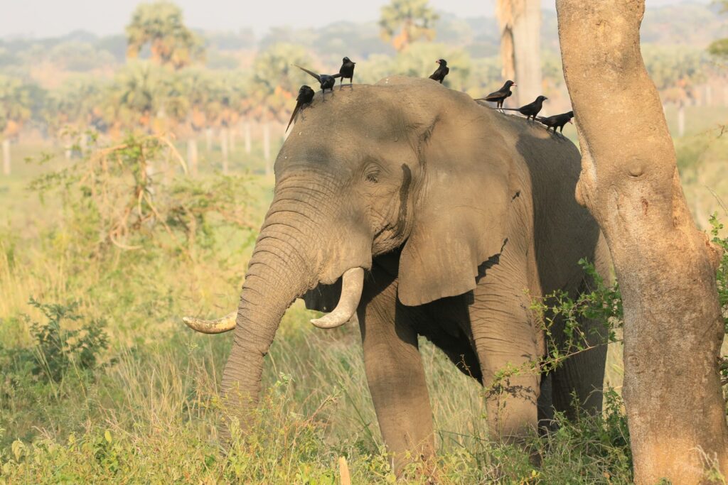
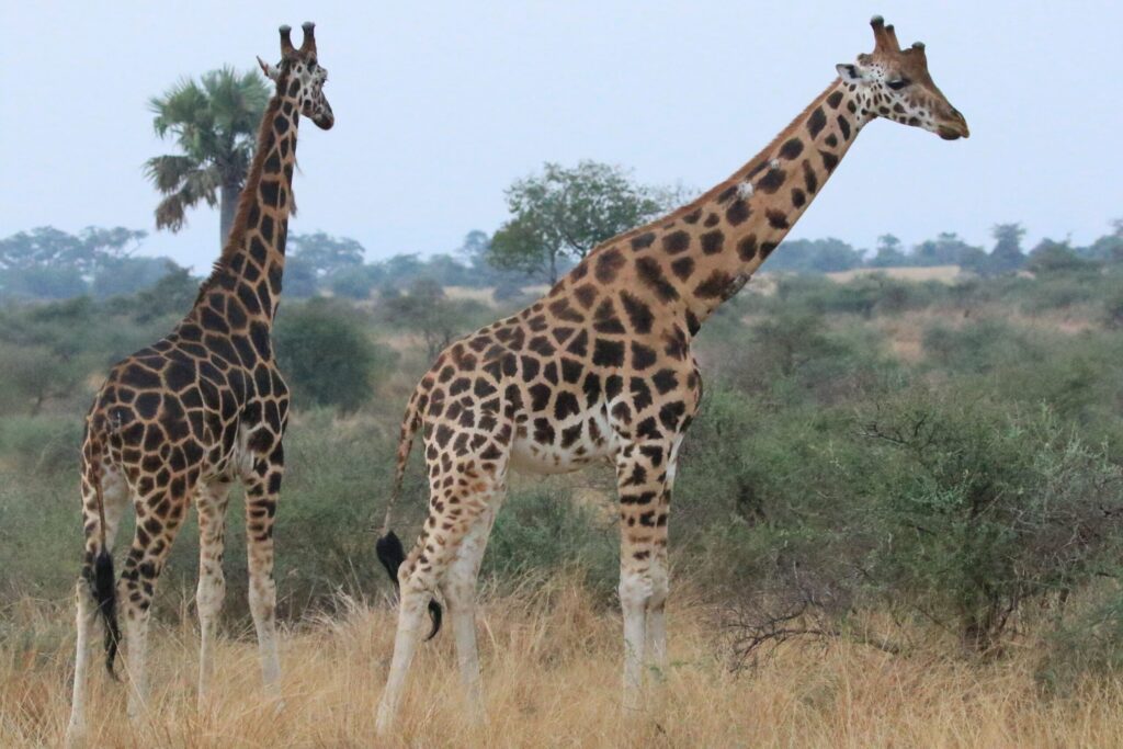
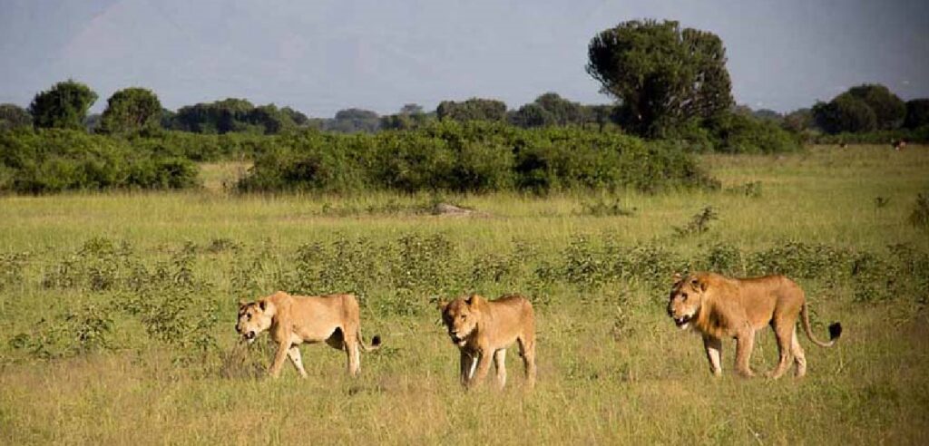
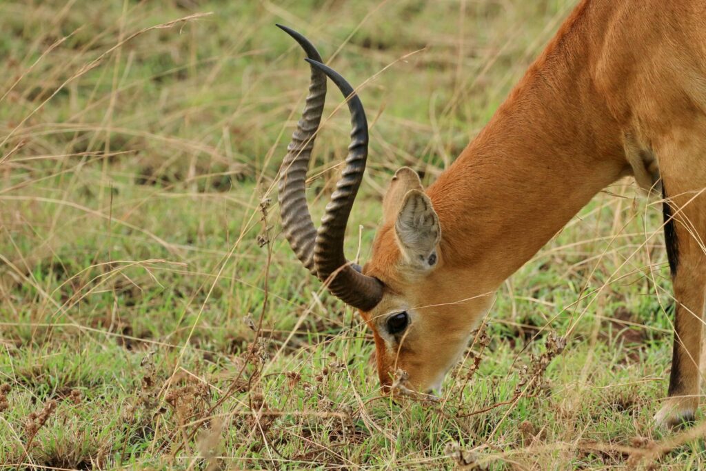
Toro Semliki Wildlife Reserve was established as a game reserve in 1926 and was among the first protected areas to be gazetted. The main reason was to protect the large numbers of Uganda Kobs in the area. It covers an area of 542 km2. It is located in western Uganda, within Ntoroko and Kabarole districts.
Description:
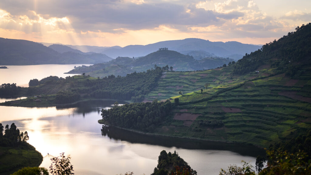
Toro Semliki Wildlife Reserve enjoys a dramatic rift valley setting between the Rwenzori, Kijura escarpment and Lake Albert. The dominant vegetation type is the open acacia-combretum woodland and grassy savannah, interspersed with patches of Borassus palm forest, significant belts of riparian woodland along the main watercourses, as well as some extensive swamps towards Lake Albert. The reserve itself is topographically unremarkable, set at a relatively low altitude starting from around 700m above sea level, but on a clear day, the setting is truly awesome, with the sheer rift valley escarpment rising sharply from the eastern shore of Lake Albert, the 2500m-high Congolese Blue mountains on the western horizon and the mighty glacial peaks of the Rwenzori visible to the south-west.
Katonga
Katonga Wildlife Reserve with an area of 207 square kilometers was gazetted in 1964 as a game reserve, to serve as a corridor for migrating wildlife from Western Uganda to Tanzania and Sudan. It became a Wildlife Reserve in 1996 when the former Game Department and Uganda National Parks merged to form Uganda Wildlife Authority (UWA). Currently, the reserve is managed by UWA under the Kibale Conservation Area administration with a Warden In-Charge based at the Reserve Head Office at Kikorogoto.
Location and access
The 207km2 Katonga Wildlife Reserve is a savannah grassland ecosystem located within Kyenjojo and Kamwenge Districts. The journey into the Reserve is a three-hour drive from Kampala to Kyegegwa Town Council. At Kyegegwa, detour southwards for 42 km following well visible signposts.

Ajai
Geographical Location
West Bank of the Nile between Pakwach and Nimule, about 10km north of Inde and 32km east-south-east of Arua. 2°55’N, 3r25’E.
Altitude 700-1,000m
Area 148km2 (15,800ha)
Physical Features
This area of rivers and riverine swamp borders the River Nile and two tributaries, the Ala and Acha. The reserve includes a number of swamp islands including Ajai island formed by gradual deposition of soil from the hills by the Ala River. The swamp is surrounded by savanna woodland. Most of the swamp is flooded during the rainy months (June to January) but dries out from February to May
Bugungu
Geographical Location
Between Murchison Falls National Park and the north shore of Lake Mobutu Sese Seko (Lake Albert). 2°15’N, 3r30’E.
Altitude 600- 1,300m
Area 52,000ha; contiguous to Murchison Falls National Park (384,000ha) and Karuma Wildlife Reserve (82,000ha)
Physical Features
The features are similar to the southern sector of Murchison Falls National Park. Bugungu Wildlife Reserves and Karuma Wildlife Reserve constitute a buffer zone for the southern boundary of Murchison Falls National Park.
Karuma
Geographical Location
Western Uganda, adjoining Murchison Falls National Park to the north. Approximately r50’N, 3r45’E.
Altitude 900m – 1,300m
Area 675km2 (82,000ha); contiguous to Murchison Falls National Park 3877km2 (384,000ha) and Bugungu Wildlife Reserve 473km2 (52,000ha)
Physical Features
This is an area of gentle relief crossed by several watercourses, south of the Victoria Nile.
Kigezi
Geographical Location
The reserve is a southward annex to Queen Elizabeth National Park, separated from Lake Edward by a 7km wide sector of the park. 0°30’S, 29°50’E.
Altitude About 1,050m
Area 265km2 (33,000ha); contiguous to Queen Elizabeth National Park 2056km2 (197,800ha) and its associated reserves
Physical Features
Situated on the western arm of the Central African rift valley.
Kyambura
Geographical Location
South-west Uganda bordering the southeast of the Kazinga Channel and the south shore of Lake George. 0°05’S, 30°05’E. Altitude 700- 1,1 00m Area 15,700ha; contiguous to Queen Elizabeth National Park (197,800ha) and its associated reserves Uganda Land Tenure Government Physical Features The terrain is characterized by small hills and about 10 crater lakes above the east wall of the western Rift Valley (here interrupted by the vast upheaval of the Ruwenzori range). The area also contains a number of swamps. The boundary with Queen Elizabeth National Park is defined by the Kyambura River which flows into the Kazinga Channel. Vegetation Savanna grassland and deciduous thickets
Matheniko
Geographical Location
In the Karamoja region, just north of Moroto, extending along the border with Kenya. 2°40′-3°07’N, 34°10′-34°50’E. lUCN Directory of Afrotropical Protected Areas Altitude 1,200- 1,600m Area 160,000ha; contiguous to Bokora Corridor Game Reserve (205,600ha) and the eastern Uganda complex of Controlled Hunting Areas Land Tenure Government
Physical Features
The reserve is part of the Karamoja plateau. It is bounded on the east by the Great Rift escarpment which forms the Uganda/Kenya border in this area and is interrupted in the south by spurs and extensions of higher ground. Vegetation Thorny deciduous thicket
Pian-Upe
Geographical Location
Eastern Uganda, north of Mount Elgon and SOkm east of Scroti. I’SO’-I’IS’N, 34”34”05′-34°50’E. Altitude l,000-3,06Sm Area 231,400ha; connected to Matheniko Game Reserve (160,000ha) by the Bokora Corridor Land Tenure Government Physical Features This is a high plateau area of rolling plains with black cotton soil drained by intermittent watercourses flowing westwards into Lake Kyoga. Most of the area is subject to inundation during the rainy season. Mount Kadam (previously Mount Debasien) near the border with Kenya, is the highest point in the reserve at 3,068m. VegetatlonT Most of the area is wooded savanna grasslands with some forest in the north on the margins of a higher ridge.
Bokora
Geographical Location
In eastern Uganda between Moroto and Mount Elgon, between Matheniko Game Reserve and Pian-Upe Game Reserve, along the south-western boundary of the Karamoja region. 2”07′-2”45’N, 33°50′-34°50’E. Altitude 1,000-2, 100m Area 205,600ha; contiguous to Pian-Upe Game Reserve (228,710ha) and Matheniko Game Reserve (158,650ha). Flanked on remaining sides by four Controlled Hunting Areas totaling over 2,000,000 ha, which are contiguous to four other Controlled Hunting Areas and Kidepo Valley National Park (134,400ha).
Public Physical Features
The reserve is a plateau with a few inselbergs, typical of the southern Karamoja region. The climate is relatively dry.
Kabwoya
However, in the early 1960s, the Uganda Game Department sought to exert more control over sport hunting in Uganda by declaring certain areas to be Controlled Hunting Areas (CHAs) in which sport hunting could only be carried out by special license, and against carefully set quotas.
The Kaiso-Tonya area on the shoreline of Lake Albert was gazetted as a CHA in 1963 as it harbored isolated but important populations of Uganda kob, buffalo, and hartebeest. Game Department records indicate that hunting in Kaiso-Tonya CHA, and in its smaller neighbor Buhuka CHA, was properly regulated until the mid-1970s. Thereafter, with the breakdown of law and order in Uganda, no further management of either area took place for the next 20 years.
The Kabwoya-Kaiso Wildlife Management Area (KKWMA) is in Hoima District and covers the majority of the land formerly known as the Kaiso-Tonya Controlled Hunting Area. The KKWMA has a total area of 194 sq. km and comprises the Kabwoya Wildlife Reserve (KWR, area 87 sq. km) and the adjacent Kaiso-Tonya Community Wildlife Area (KTCWA, area 107 sq. km).